Built for enthusiasts
Everything you need to watch the skies, with honest handling of what free ADS-B data can and can't do.
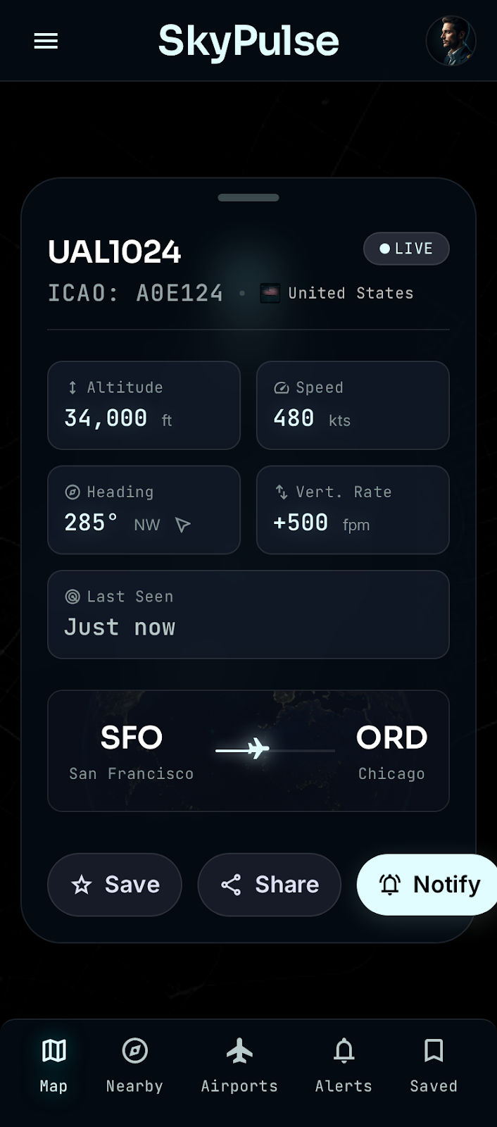
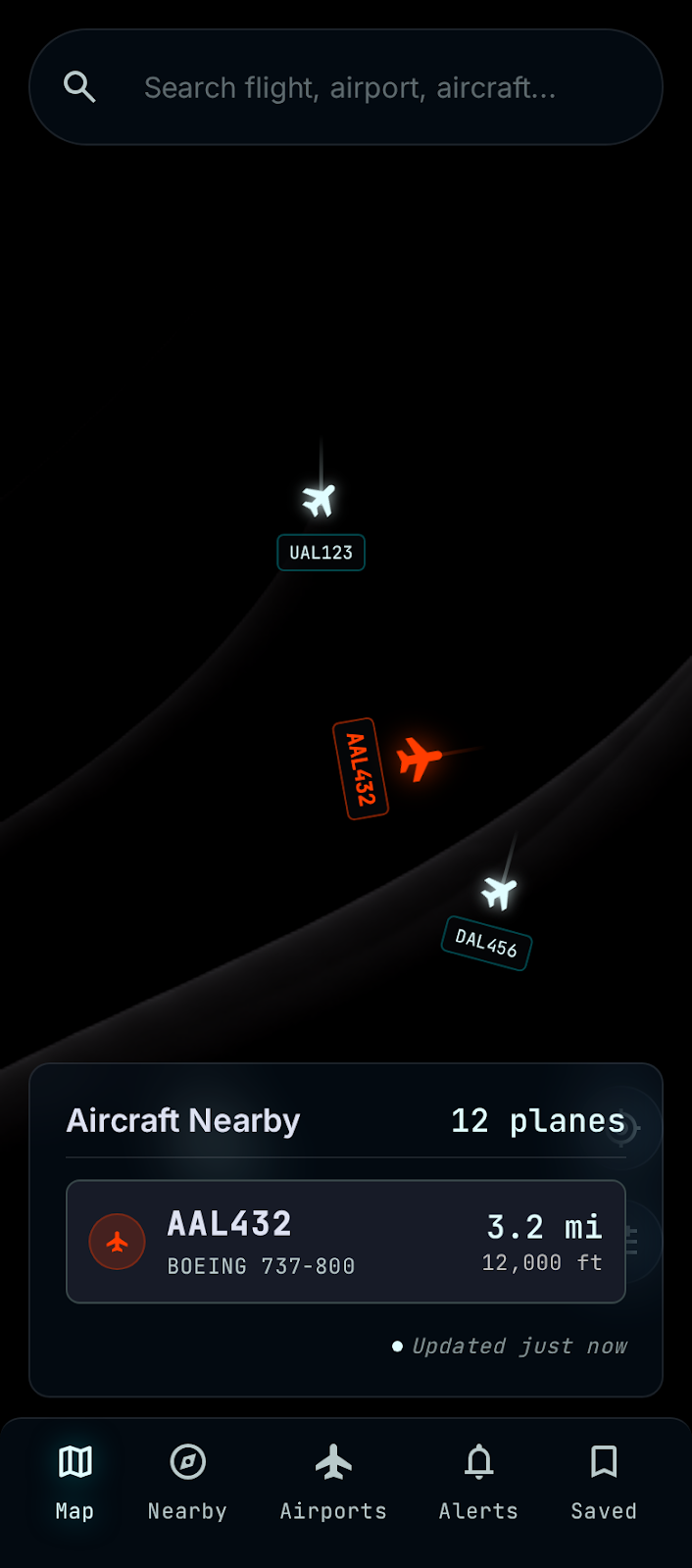
Live map
OpenStreetMap tiles with aircraft markers rotated to heading. Tap any plane for a cockpit-style detail sheet.
Share a flight
Send any flight to a friend with one tap. They open a link to see its live position, route and details on the web — and can jump straight into the app.
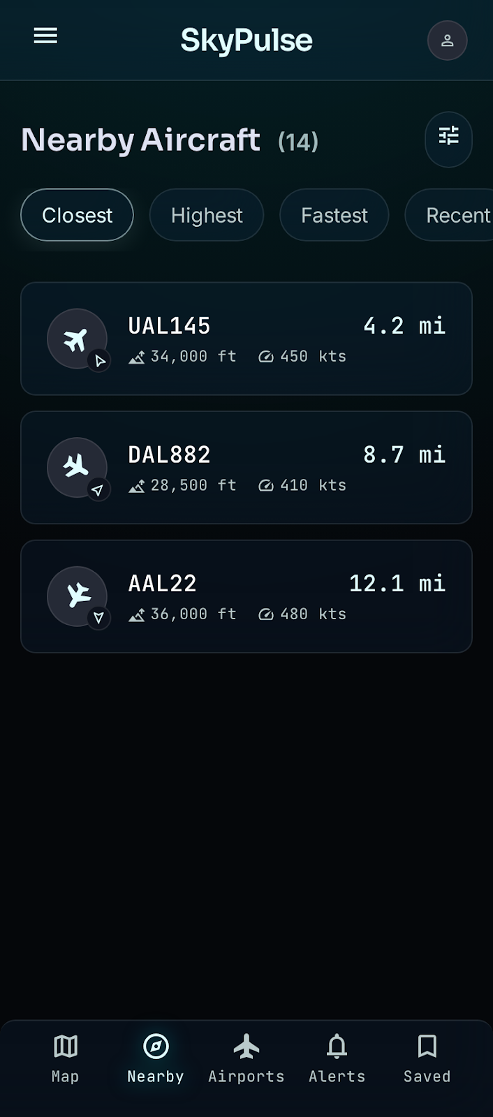
Nearby & sorting
See aircraft around you sorted by closest, highest, fastest, or most recently seen.
Routes & ETA
Origin → destination (via the free adsbdb API) with an estimated progress bar and time-remaining from the live position.
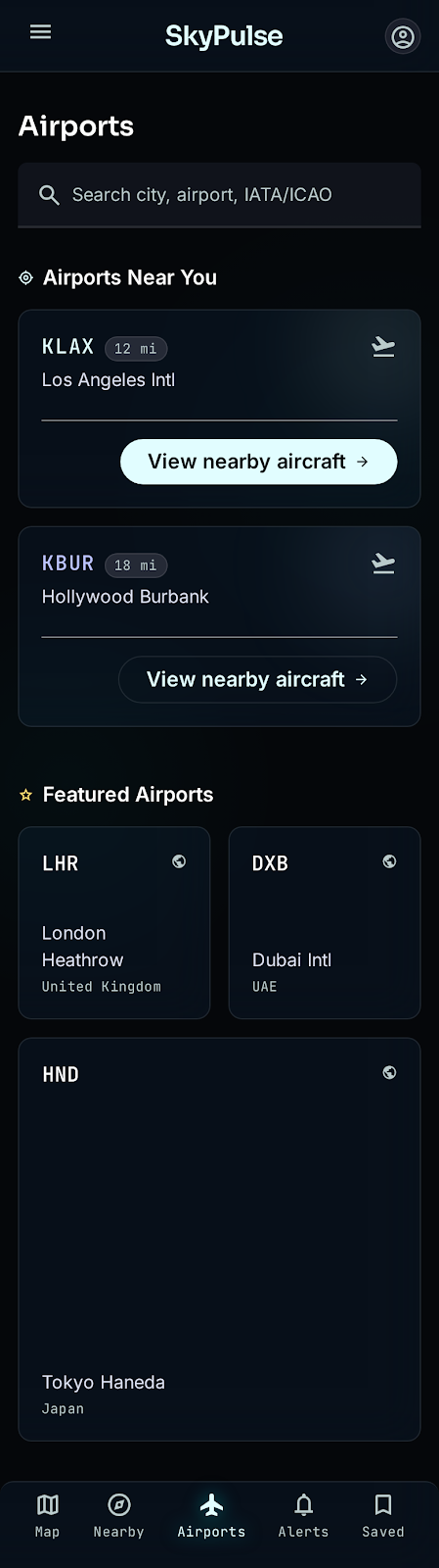
Airport lookup
Search the full OpenFlights database by name, city, country, IATA or ICAO — plus airports near you.
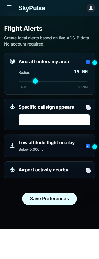
Local alerts
On-device notifications when aircraft enter your area, a callsign appears, or a flight is low nearby. No backend.
Offline-aware
Cached snapshots and clear loading / empty / error / offline states keep things resilient.
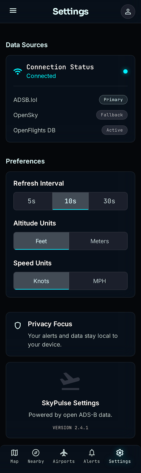
Privacy-first
No account. Saved items and alerts stay on your device. Location is used only on-device.
Screens
Futuristic glassmorphism — a cockpit HUD that's still easy to read.
Also on the web
SkyPulse is available as a full Progressive Web App — same live map, same tabs, same data. Works in any browser. Install to your iPhone home screen for a native-feel experience, or just open it and start tracking.
iPhone & iPad
Install to your home screen from Safari for a standalone app — no App Store needed. Alerts work when the PWA is open.
Synced with the app
Sign in with your Google account or email to sync saved aircraft, airports, and areas with your Android device via Firebase.
Full feature set
Live map, Nearby list, Airport search, Alerts, and Saved items — the complete experience, no install required.
100% free, open data
No FlightAware, FlightRadar24, AviationStack, RapidAPI, or paid Google Maps. No key, no login.
| Layer | Source | Notes |
|---|---|---|
| Live aircraft | airplanes.live | Radius search, CORS-enabled, no key required |
| Flight routes | adsbdb | Callsign → origin/destination (no key) |
| Airports / airlines | OpenFlights | Bundled, imported into Room / cached in browser |
| Map tiles | OpenStreetMap | via osmdroid (Android) / Leaflet (web) |
Free ADS-B is best-effort: not every aircraft is guaranteed, coverage varies by area and time, data can be delayed, and some military/private aircraft may be hidden. Route/gate/boarding status isn't available on free feeds — SkyPulse says so plainly.